Construction surveying plays a pivotal role in the successful execution of any construction project. It encompasses a range of activities that ensure the accurate measurement and mapping of land, which ultimately influences the project’s timelines and budgets. In an industry where precision is paramount, understanding the implications of construction surveying can lead to more efficient project management and cost savings.
The Importance of Accurate Surveying
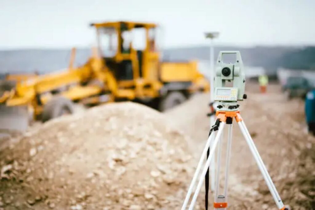
Accurate surveying is fundamental to any construction project. It provides the necessary data that informs design, planning, and execution. Without precise measurements, the risk of errors increases significantly, which can lead to costly delays and budget overruns.
Defining Project Boundaries
One of the primary functions of construction survey is to define project boundaries. This involves marking out the exact limits of the land where construction will take place. If boundaries are not accurately defined, disputes may arise with neighbouring properties, leading to potential legal complications and delays in the project timeline.
Furthermore, establishing clear boundaries is essential for obtaining the necessary permits and approvals from local authorities. Any discrepancies in boundary definitions can result in additional time spent rectifying issues, which can disrupt the entire project schedule. In some cases, a lack of clarity in boundary definitions may even lead to the need for extensive legal mediation, which can drain both time and financial resources that could have been better allocated to the construction itself.
Topographical Surveys
Topographical surveys provide crucial information about the terrain and existing features of the land. This data is vital for architects and engineers as it influences design decisions, such as drainage systems, foundations, and landscaping. An inaccurate topographical survey can lead to designs that are not feasible, necessitating costly redesigns and further delays.
Additionally, understanding the topography helps in planning the logistics of construction, including the placement of machinery and materials. This foresight can significantly reduce downtime and improve overall efficiency, ultimately keeping the project within budget. Moreover, a thorough topographical survey can also reveal potential environmental concerns, such as flood zones or protected wildlife habitats, which must be taken into account to ensure compliance with environmental regulations. By addressing these factors early in the planning process, projects can avoid significant setbacks and ensure a smoother path to completion.
Impact on Project Timelines
The timeline of a construction project is often dictated by the accuracy and efficiency of the surveying process. Delays in surveying can cascade through the entire project, affecting subsequent phases and leading to missed deadlines.
Initial Delays Due to Inaccurate Surveys
When construction surveying is rushed or poorly executed, the initial phases of a project can be severely impacted. For example, if a survey fails to identify critical site conditions, such as underground utilities or unstable soil, construction teams may encounter unexpected challenges. These challenges can halt progress until the issues are resolved, leading to significant delays.
Moreover, if the surveying data is inaccurate, it may necessitate rework or adjustments during the construction phase. This not only extends the timeline but also increases labour costs and material expenses, further straining the project budget.
Scheduling and Resource Allocation
Effective construction surveying allows for better scheduling and resource allocation. By having accurate data from the outset, project managers can develop realistic timelines and allocate resources more efficiently. This includes scheduling subcontractors, ordering materials, and coordinating with various stakeholders.
When surveying is conducted thoroughly, it provides a clear roadmap for the project, allowing for smoother transitions between phases. This proactive approach helps to avoid bottlenecks and ensures that the project progresses as planned, minimising the risk of delays.
Additionally, the integration of advanced surveying technologies, such as 3D laser scanning and drone surveying, has revolutionised the accuracy and speed of data collection. These modern techniques not only enhance the precision of the surveys but also allow for real-time updates, enabling project managers to make informed decisions swiftly. As a result, the overall efficiency of the construction process is significantly improved, reducing the likelihood of unforeseen setbacks that could derail the project timeline.
Furthermore, effective communication among all parties involved is crucial for maintaining the project schedule. Regular updates and collaborative planning sessions can help ensure that everyone is on the same page regarding the surveying results and any potential issues that may arise. This level of transparency fosters a more cohesive working environment, where teams can quickly adapt to changes and keep the project moving forward without unnecessary delays.
Budget Considerations
In addition to affecting timelines, construction surveying has a direct impact on project budgets. Accurate surveying can lead to significant cost savings, while inaccuracies can result in unexpected expenses that can derail financial plans.

Cost of Rework and Delays
One of the most significant financial implications of poor surveying is the cost of rework. When construction teams must redo work due to inaccurate measurements or unexpected site conditions, the costs can quickly escalate. This includes not only the cost of materials and labour but also the potential for penalties associated with missed deadlines.
Additionally, delays caused by surveying issues can lead to increased overhead costs. For instance, if a project is delayed, the costs associated with site management, equipment rental, and insurance can accumulate, further straining the budget. Moreover, the ripple effect of such delays can extend beyond the immediate project, affecting future contracts and the reputation of the construction firm. Clients may become hesitant to engage with a company that has a history of delays, leading to a potential loss of future business opportunities.
Optimising Resource Use
Accurate surveying optimises the use of resources, which is crucial for keeping a project within budget. When surveyors provide precise data, project managers can make informed decisions about resource allocation. This includes determining the right amount of materials needed, scheduling labour effectively, and minimising waste.
By utilising resources efficiently, construction teams can avoid unnecessary expenditures and ensure that the project remains financially viable. This not only helps in adhering to the budget but also enhances the overall profitability of the project. Furthermore, effective resource management can lead to sustainable practices, as minimising waste contributes to environmental conservation. In an era where sustainability is increasingly valued, demonstrating a commitment to responsible resource use can also enhance a company’s standing in the eyes of clients and stakeholders, potentially opening doors to new projects that prioritise eco-friendly practices.
Technological Advancements in Surveying
The construction industry has seen significant technological advancements in surveying techniques, which have further enhanced accuracy and efficiency. These innovations have a profound impact on project timelines and budgets.
Use of Drones
Drones have revolutionised the surveying process by providing aerial imagery and data collection capabilities that were previously unattainable. They can quickly cover large areas, capturing high-resolution images and generating detailed topographical maps.
This technology not only speeds up the surveying process but also improves accuracy, reducing the likelihood of errors that can lead to delays and budget overruns. By incorporating drones into the surveying process, construction teams can achieve a more comprehensive understanding of the site, allowing for better planning and execution.
3D Modelling and BIM
Building Information Modelling (BIM) and 3D modelling have transformed how construction projects are designed and managed. These technologies allow for the creation of detailed digital representations of a project, incorporating data from surveys and other sources.
With 3D models, project teams can visualise the construction process, identify potential issues, and make adjustments before breaking ground. This proactive approach minimises the risk of errors and rework, ultimately leading to more accurate timelines and budgets.
Conclusion
Construction surveying is a critical component of project management that significantly impacts timelines and budgets. Accurate surveying not only defines project boundaries and informs design decisions but also facilitates effective scheduling and resource allocation. Conversely, inaccuracies can lead to costly delays and rework, jeopardising the financial viability of a project.
As technological advancements continue to shape the surveying landscape, the potential for improved accuracy and efficiency will only increase. Embracing these innovations can lead to better project outcomes, ultimately ensuring that construction projects are completed on time and within budget.
In an industry where precision is key, investing in thorough and accurate construction surveying is essential for success. By prioritising this critical phase of project management, stakeholders can mitigate risks, optimise resources, and achieve their construction goals with confidence.
Related : How Underground Utility Locators Prevent Costly Damages